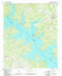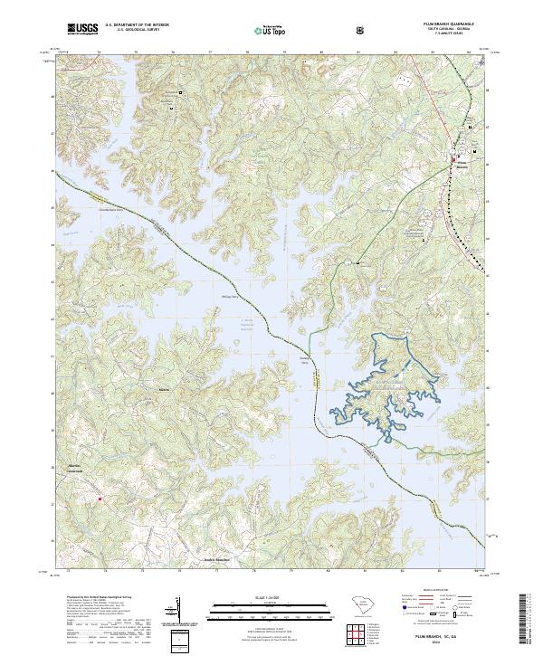
2024 Map of Plum Branch
USGS Topo · Published 2024About this map
The Savannah River defines the border between South Carolina and Georgia, creating a complex landscape of fingers and inlets along the J. Strom Thurmond Reservoir. This modern survey documents the rural character of McCormick County, South Carolina, where historic ferries like Chamberlains Ferry, McCoys Ferry, and Sturkeys Ferry once operated before the reservoir's expansion. The area is marked by established community anchors such as Springfield A M E Church and the Pine Grove African Methodist Episcopal Church, alongside several family and community burial grounds including the Freeland Family Cem and Republican Cem. Within the Sumter National Forest, the terrain is carved by numerous tributaries including Hawe Creek, Benningsfield Creek, and Soap Creek, while small settlements like Plum Branch and Martins Crossroads serve as local navigation points in this heavily forested and water-dominated region.
Find a feature on this map
90 named features on this map. Tap any name to fly to it.
Don’t see what you’re looking for? This feature index may not catch every label — zoom into the map to look around manually.
Map Details
Editions of this 2024 Plum Branch Map
This is the sole edition of this map. No revisions or reprints were ever made.