Loading...
Loading map...2023 Map of Plumville
USGS Topo · Published 2023About this map
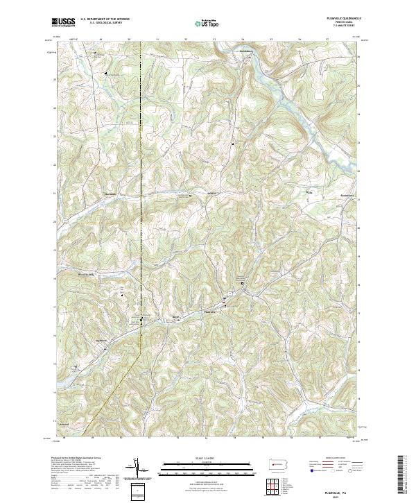
Plumville and the surrounding townships in Indiana County and Armstrong County are defined by a complex network of narrow valley settlements and upland ridges. The landscape is dotted with numerous small, denominational burial grounds and places of worship, including the Old Mahoning Baptist Cem, Beracha Presbyterian Church Cem, and the Sacred Heart Cem. These sites, concentrated around crossroads like Beyer and Sagamore, reflect the area's ancestral community structure.
Find a feature on this map
92 named features on this map. Tap any name to fly to it.
Don’t see what you’re looking for? This feature index may not catch every label — zoom into the map to look around manually.
Map Details
Date Portrayed2023
Date Published2023
PublisherU.S. Geological Survey
Map TypeTopographic
Scale1:24000
Physical Dimensions24 x 29 inches
Editions of this 2023 Plumville Map
This is the sole edition of this map. No revisions or reprints were ever made.
Historical Maps of Washington Township Through Time
Featured Locations
Source Details
SourceU.S. Geological Survey
CopyrightPublic Domain