2022 Map of Plymouth
USGS Topo · Published 2022About this map
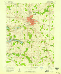
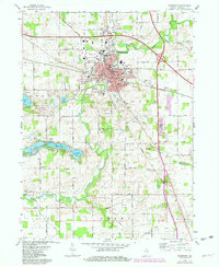
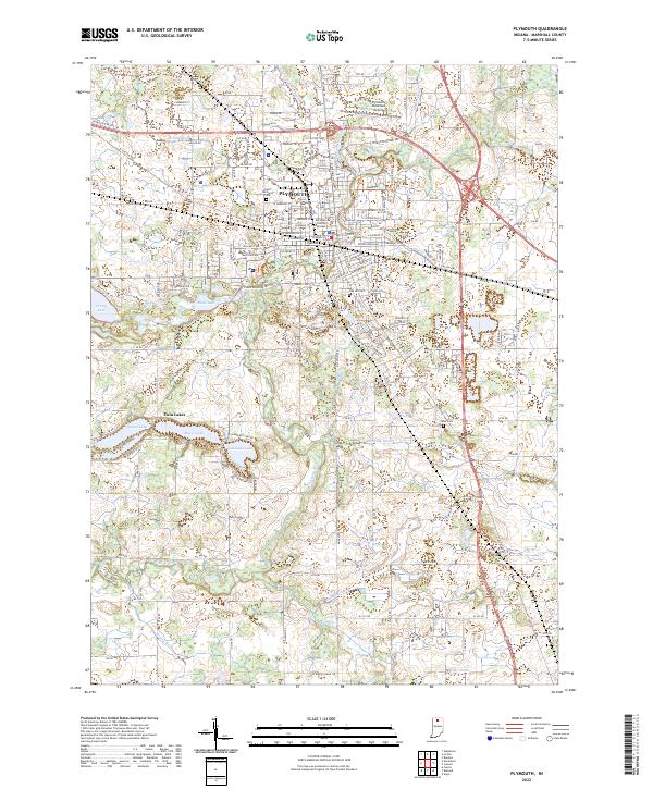
Plymouth serves as the focal point of this northern Indiana landscape, where the Yellow River winds through the heart of the city. The street grid is well-defined, anchored by the Marshall County Courthouse and extending out toward the Plymouth Municipal Airport to the north. This survey documents the area's development and natural features, highlighting a series of glacial lakes including Lawrence Lake, Myers Lake, and Holem Lake to the southwest, which characterize the Twin Lakes settlement.
Find a feature on this map
96 named features on this map. Tap any name to fly to it.
Don’t see what you’re looking for? This feature index may not catch every label — zoom into the map to look around manually.
Map Details
Editions of this 2022 Plymouth Map
This is the sole edition of this map. No revisions or reprints were ever made.
Historical Maps of Indiana Through Time
3 maps found