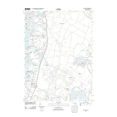
2012 Map of Pocasset
USGS Topo · Published 2012About this map
Phinneys Harbor and the Pocasset River define the intricate shoreline of this Cape Cod landscape, where maritime tradition meets modern infrastructure. The map details a series of coastal settlements including Monument Beach, North Pocasset, and Cataumet, each connected by the rail corridor featuring stops at Pocasset Station and Cataumet Station. The Cape Cod Canal is visible at the northern edge, anchored by Taylor Point and the Railroad Bridge.
Find a feature on this map
215 named features on this map. Tap any name to fly to it.
Don’t see what you’re looking for? This feature index may not catch every label — zoom into the map to look around manually.
Map Details
Editions of this 2012 Pocasset Map
This is the sole edition of this map. No revisions or reprints were ever made.
Other maps of this area

1886 · Falmouth
USGS Topo · 1:62,500

1886 · Plymouth
USGS Topo · 1:62,500

1888 · Barnstable
USGS Topo · 1:62,500

1888 · Falmouth
USGS Topo · 1:62,500

1889 · Plymouth
USGS Topo · 1:62,500

1893 · Barnstable
USGS Topo · 1:62,500

1893 · Falmouth
USGS Topo · 1:62,500

1894 · Plymouth
USGS Topo · 1:62,500

1915 · Falmouth
USGS Topo · 1:62,500

1920 · Falmouth
USGS Topo · 1:62,500