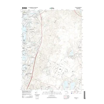
2015 Map of Pocasset
USGS Topo · Published 2015About this map
Buzzards Bay and the western reaches of the Intracoastal Waterway define this coastal landscape, where the Railroad Bridge stands as a prominent engineering landmark. The map documents a densely settled shoreline stretching from Gray Gables and Bourne south through Monument Beach, Pocasset, and Cataumet. Inland, the massive footprint of Camp Edwards and the Cape Cod Coast Guard Air Station occupies much of the eastern terrain, contrasted by a network of freshwater ponds such as Snake Pond and Johns Pond. Local genealogy is well-served by the presence of numerous burial grounds, including the Old Bourne Cem and Oakland Grove Cem. The map illustrates the transition from the maritime industry of the Massachusetts Maritime Acad to the extensive military infrastructure that characterizes the interior of the Cape.
Find a feature on this map
222 named features on this map. Tap any name to fly to it.
Don’t see what you’re looking for? This feature index may not catch every label — zoom into the map to look around manually.
Map Details
Editions of this 2015 Pocasset Map
This is the sole edition of this map. No revisions or reprints were ever made.
Other maps of this area

1886 · Falmouth
USGS Topo · 1:62,500

1886 · Plymouth
USGS Topo · 1:62,500

1888 · Barnstable
USGS Topo · 1:62,500

1888 · Falmouth
USGS Topo · 1:62,500

1889 · Plymouth
USGS Topo · 1:62,500

1893 · Barnstable
USGS Topo · 1:62,500

1893 · Falmouth
USGS Topo · 1:62,500

1894 · Plymouth
USGS Topo · 1:62,500

1915 · Falmouth
USGS Topo · 1:62,500

1920 · Falmouth
USGS Topo · 1:62,500