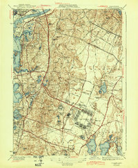
1943 Map of Pocasset
USGS Topo · Published 1943About this map
Camp Edwards dominates the central landscape of this 1943 edition, showing the massive military footprint at the height of World War II alongside Otis Field. The transition from peaceful coastal villages to a mobilization hub is clear, with culture revisions by the Corps of Engineers documenting the base's growth. Along the western shore, the New York New Haven and Hartford RR links established seaside communities like Pocasset, Cataumet, and Monument Beach.
Find a feature on this map
91 named features on this map. Tap any name to fly to it.
Don’t see what you’re looking for? This feature index may not catch every label — zoom into the map to look around manually.
Map Details
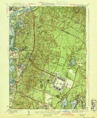
Editions of this 1943 Pocasset Map
2 editions found
Other maps of this area

1886 · Falmouth
USGS Topo · 1:62,500

1886 · Plymouth
USGS Topo · 1:62,500

1888 · Barnstable
USGS Topo · 1:62,500

1888 · Falmouth
USGS Topo · 1:62,500

1889 · Plymouth
USGS Topo · 1:62,500

1893 · Barnstable
USGS Topo · 1:62,500

1893 · Falmouth
USGS Topo · 1:62,500

1894 · Plymouth
USGS Topo · 1:62,500

1915 · Falmouth
USGS Topo · 1:62,500

1920 · Falmouth
USGS Topo · 1:62,500