2023 Map of Point of Rocks
USGS Topo · Published 2023About this map
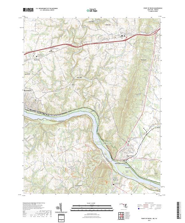
Catoctin Creek and the Potomac River define this Potomac River valley landscape, where the borders of Maryland and Virginia meet at the river's edge. The area is dominated by the Chesapeake and Ohio Canal National Historical Park, which follows the northern bank past Lander and Point of Rocks. This modern survey reveals a dense concentration of ecclesiastical history, particularly around Jefferson and Petersville, where sites like the Union Bethel African Methodist Episcopal Cem and Saint Paul's Lutheran Cem anchor long-standing communities. The transport network shows a clear evolution from the historic canal and the CSX Transportation rail lines at Washington Junction to the primary transit corridor of Jefferson Pike. South across the river, the terrain rises sharply toward Furnace Mtn and Catoctin Mtn, marking the transition into Loudoun County's upland areas near Taylorstown.
Find a feature on this map
165 named features on this map. Tap any name to fly to it.
Don’t see what you’re looking for? This feature index may not catch every label — zoom into the map to look around manually.
Map Details
Editions of this 2023 Point of Rocks Map
This is the sole edition of this map. No revisions or reprints were ever made.
Historical Maps of Jefferson Through Time
1 maps found