Old Maps of Rosemont, Maryland
Explore 31 old maps of Rosemont, spanning from 1884 to today. These high-resolution historic maps reveal how streets, neighborhoods, landmarks, and natural features evolved over time — perfect for genealogy, metal detecting, research, and local history exploration.
What you can do with these maps:
- See how Rosemont changed over time: Compare historical maps to modern-day views to trace roads, homesites, rail lines & more.
- View detailed metadata: Each map includes creators, publishers, year, scale, and archive source.
- Overlay maps with satellite & LiDAR: Visualize the past alongside modern tools to explore terrain & human change.
- Trusted historical sources: Maps sourced from the USGS, Library of Congress, and other archives.
- Access maps your way: View online, download high-res files, or order prints for personal or research use.
Start exploring old maps of Rosemont to uncover forgotten places, hidden landmarks, and the deep history beneath your feet.
Rosemont, MD maps
(31)- 1884 Map of Harpers Ferry
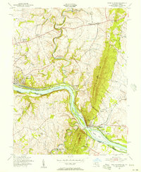
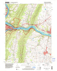
 1884 Harpers Ferry1884 Print · USGSThe confluence of the Potomac and Shenandoah rivers is captured in the mid-1880s, documenting a landscape of strategic gaps and vital transit corridors. Researchers can trace the path of the Chesapeake and Ohio Canal and locate historic river crossings like Conrad Ferry and Castleman Ferry.
 - 1891 Map of Harpers Ferry
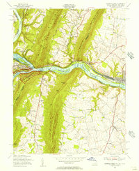
 1891 Harpers Ferry1891 Print · USGSThe tri-state borderlands of the Potomac and Shenandoah valleys were a vital hub of transport and trade in the late 1800s. Researchers can trace historic river crossings like Castlemans Ferry, follow the route of the Chesapeake and Ohio Canal, or locate family-named settlements like Oatlands and Taylorstown.
 - 1893 Map of Harpers Ferry, 1898 Print
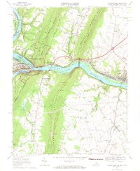
 1893 Harpers Ferry1898 Print · USGSThe tri-state region of the Potomac and Shenandoah valleys is captured here in the late nineteenth century, showing a landscape defined by water and rail. Trace the historic Chesapeake and Ohio Canal or locate local landmarks like Snyder Mills and Harpers Ferry.7 unique versions available
 - 1908 Map of Middletown
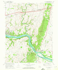
 1908 Middletown1908 Print · USGSThe Potomac River valley in the early twentieth century shows a landscape defined by the convergence of major rail lines and the historic Chesapeake and Ohio Canal. Genealogists and historians can trace the foundations of Eakles Mills, Burkittsville, and Washington Junction.
 - 1910 Map of Antietam
 1910 Antietam1910 Print · USGSMaryland's borderlands and the Potomac River valley are captured here in the early twentieth century. Genealogists can locate family landmarks like Garretts Mill, trace the Chesapeake and Ohio Canal, or find historic sites including Dunkard Church.6 unique versions available
 - 1944 Map of Point Of Rocks
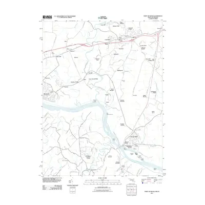
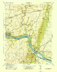 1944 Point Of Rocks1944 Print · USGSThe Potomac River corridor in the mid-1940s reveals a landscape defined by the parallel paths of the Baltimore and Ohio railroad and the historic Baltimore and Ohio Canal. Genealogists and historians can trace riverside settlements like Catoctin Sta (Lander P O) and rural landmarks such as Lewis Mill and St Marks Church.
 - 1944 Map of Harpers Ferry
 1944 Harpers Ferry1944 Print · USGSThe confluence of the Potomac and Shenandoah rivers is captured in the mid-1940s, showing a landscape defined by mountain gaps and rail corridors. Researchers can trace the Chesapeake and Ohio Canal (Abandoned) or locate local landmarks like Stoker College and Garretts Mill.
 - 1948 Map of Baltimore
 1948 Baltimore1948 Print · USGSMaryland and Pennsylvania crossroads are captured in the late 1940s, showing a landscape defined by historic rail lines and major military installations. Genealogists can trace family connections in Gettysburg, Westminster, and near the U.S. Naval Academy in Annapolis.2 unique versions available
 - 1953 Map of Point of Rocks
 1953 Point of Rocks1953 Print · USGSThe Potomac River borderlands thrive in the early 1950s as a vital corridor for the Baltimore and Ohio railroad and historic canal. Researchers can pinpoint long-standing community centers like the Lander P O, St Marks Church, and Lewis Mill.2 unique versions available
 - 1953 Map of Harpers Ferry
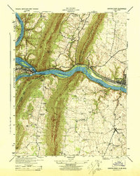
 1953 Harpers Ferry1953 Print · USGSHarpers Ferry sits at the heart of this mid-century survey where the Potomac and Shenandoah rivers meet during a period of transition for the region's rail and canal heritage. Trace the grounds of Storer College and locate rural landmarks like Garretts Mill and the C and O Canal.
 - 1954 Map of Baltimore
 1954 Baltimore1954 Print · USGSThe Mid-Atlantic region in the early fifties shows a landscape of growing suburban centers and heavy rail corridors. Trace mid-century transit networks and military landmarks from the Aberdeen Proving Ground to the Gettysburg National Military Park.
 - 1955 Map of Point Of Rocks, 1956 Print
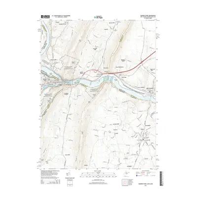
 1955 Point Of Rocks1956 Print · USGSThe river gap at Point of Rocks was a vital Maryland transportation nexus in the mid-fifties, where the rail and canal era met the river. Researchers can trace historic church sites like St Marks Ch and small hubs like Slabtown or Bells Mill.2 unique versions available
 - 1955 Map of Harpers Ferry, 1956 Print
 1955 Harpers Ferry1956 Print · USGSThe tri-state junction of West Virginia, Maryland, and Virginia is captured here during the mid-fifties as modern preservation began to take shape. Researchers can trace the Appalachian Trail, the historic Chesapeake and Ohio Canal, and local landmarks like Garretts Mill.2 unique versions available
 - 1956 Map of Baltimore
 1956 Baltimore1956 Print · USGSMid-century Maryland and Pennsylvania are captured here during a period of massive suburban and military growth across the Chesapeake region. Genealogists and historians can trace the rail corridors of the Baltimore & Ohio RR and locate landmarks like Fort McHenry or the Aberdeen Proving Ground.
 - 1957 Map of Baltimore, 1964 Print
 1957 Baltimore1964 Print · USGSMaryland and Southern Pennsylvania are shown during the mid-century expansion of the Baltimore-Washington corridor. Researchers can trace the extensive rail lines of the Baltimore & Ohio RR and locate sites like Fort Detrick and Gettysburg National Military Park.5 unique versions available
 - 1961 Map of Baltimore
 1961 Baltimore1961 Print · USGSMaryland and Pennsylvania are captured at a mid-century peak of industrial and military expansion. Genealogists and historians can trace rail corridors like the Western Maryland Ry or locate regional landmarks such as Camp Detrick and Kent Island.
 - 1969 Map of Harpers Ferry, 1971 Print
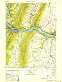
 1969 Harpers Ferry1971 Print · USGSThe Potomac and Shenandoah rivers converge at the turn of the 1970s, marking the historic meeting point of Maryland, Virginia, and West Virginia. Trace the remnants of the Chesapeake and Ohio Canal, the route of the Baltimore and Ohio Railroad, and rural family sites like Garretts Mill.3 unique versions available
 - 1970 Map of Point Of Rocks, 1972 Print
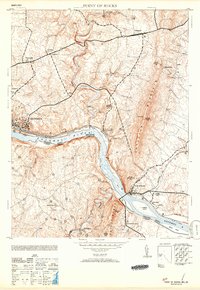
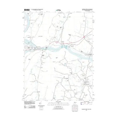
 1970 Point Of Rocks1972 Print · USGSMaryland and Virginia meet along the Potomac River corridor in the early 1970s, where rail and canal history remains visible. Genealogists and historians can trace riverside settlements like Brunswick and Lander, or locate rural landmarks like St Pauls Ch and Lewis Mill.2 unique versions available
 - 1984 Map of Frederick, 1985 Print
 1984 Frederick1985 Print · USGSMaryland's Piedmont and the Potomac River valley are shown here in the mid-eighties as suburban growth began to meet historic rural landscapes. Genealogists and historians can trace the paths of the Baltimore and Ohio RR or locate the boundaries of Antietam National Battlefield and Fort Detrick.
 - 1989 Map of Baltimore
 1989 Baltimore1989 Print · USGSThe Mid-Atlantic corridor in the late eighties is captured here, from the Baltimore harbor to the Blue Ridge foothills. Researchers can trace the sprawling footprints of Aberdeen Proving Ground, the historic grounds of Gettysburg National Military Park, and the winding Susquehanna River.
 - 1996 Map of Harpers Ferry, 2001 Print
 1996 Harpers Ferry2001 Print · USGSThe confluence of the Potomac and Shenandoah rivers remained a vital corridor for transportation and heritage in the 1990s. Genealogists and historians can trace the tri-state boundary while locating landmarks like Garretts Mill, the B & O RR, and Mt Olivet Ch.
 - 2011 Map of Point of Rocks, 2011 Print
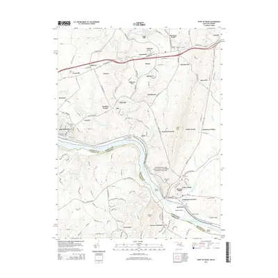
 2011 Point of Rocks2011 Print · USGSCovers Rosemont, including Brunswick, Point of Rocks, and other nearby areas
 - 2011 Map of Harpers Ferry, 2011 Print
 2011 Harpers Ferry2011 Print · USGSCovers Rosemont, including Brunswick, Lovettsville, and other nearby areas
 - 2014 Map of Harpers Ferry, 2014 Print
 2014 Harpers Ferry2014 Print · USGSCovers Rosemont, including Brunswick, Lovettsville, and other nearby areas
 - 2014 Map of Point of Rocks, 2014 Print
 2014 Point of Rocks2014 Print · USGSCovers Rosemont, including Brunswick, Point of Rocks, and other nearby areas
Showing maps 1-25 of 31
Top cities near Rosemont
- Frederick historical maps
- Leesburg historical maps
- Ballenger Creek historical maps
- Purcellville historical maps
- Brunswick historical maps
- Poolesville historical maps
See more
Frequently asked questions
- What are the different types of historical maps available for Rosemont?
- What is the oldest map of Rosemont?
- Where can I purchase historical maps of Rosemont for my home or office?
- Where can I download high-res historical maps of Rosemont?
- Are there historical topographic maps available for Rosemont?
- Is there historical aerial imagery available for Rosemont?
- Where are historical maps of Rosemont sourced from?