2021 Map of Pollock
USGS Topo · Published 2021About this map
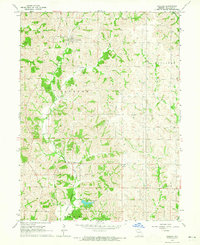
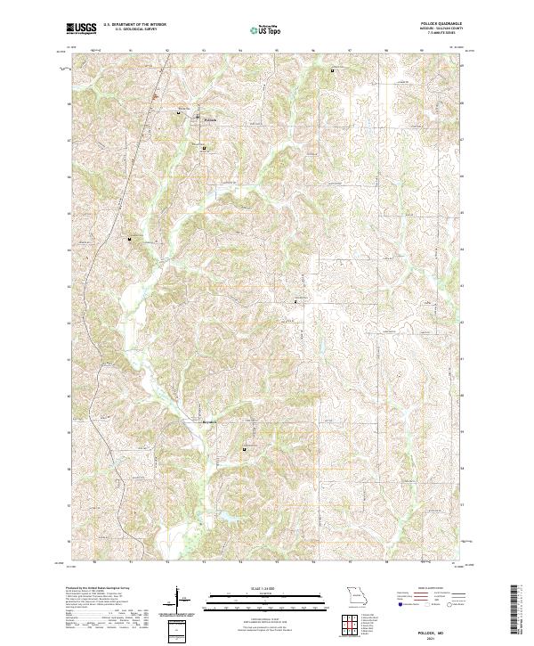
The northern Sullivan County settlements of Pollock and Boynton define this rural landscape, situated along a network of state highways and gravel roads. This 2021 survey shows a terrain carved by the E Locust Cr and W Yellow Cr, where family and community history is preserved in numerous upland burial sites. Genealogists will find many significant landmarks, including Scobee Cem, Pollock Cem, and Campbell Cem in the northern half, while Hamilton Cem and Holiday Cem serve the southern sections. The map reveals the persistence of small-town centers amidst an intricate system of rural routes like Kentucky Rd and State Hwy M. These named features provide a clear look at the enduring community structure and geographic layout of north-central Missouri.
Find a feature on this map
55 named features on this map. Tap any name to fly to it.
Don’t see what you’re looking for? This feature index may not catch every label — zoom into the map to look around manually.
Map Details
Editions of this 2021 Pollock Map
This is the sole edition of this map. No revisions or reprints were ever made.