Loading...
Loading map...2024 Map of Polo
USGS Topo · Published 2024About this map
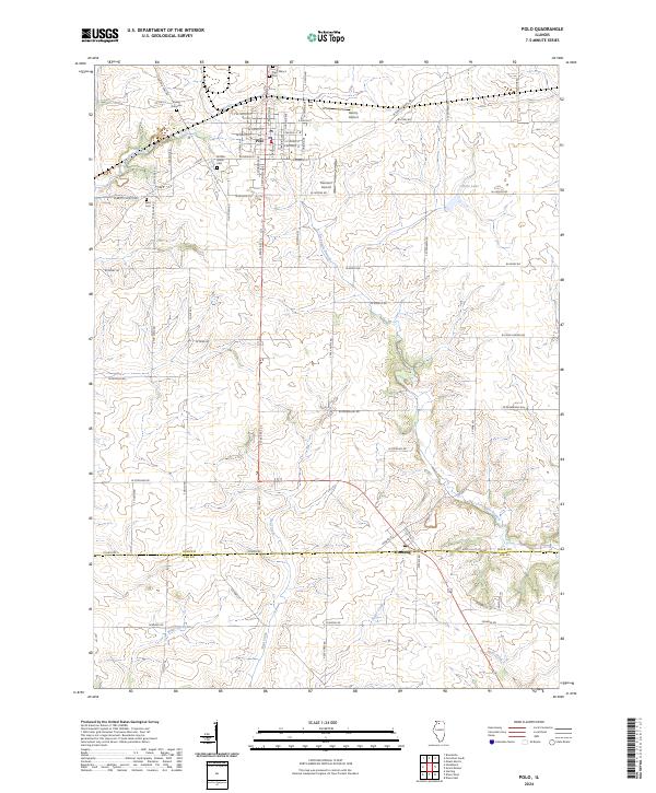
The city of Polo serves as the primary hub of this northern Illinois landscape, situated at the junction of several historical routes including Galena Trail Rd. The local heritage is deeply rooted in the land, as evidenced by the Buffalo Grove Cem, Reed Cem, and the small Durley Gravesite located north of the city. These sites, along with Saint Mary's church, anchor the community's genealogy and early development.
Find a feature on this map
75 named features on this map. Tap any name to fly to it.
Don’t see what you’re looking for? This feature index may not catch every label — zoom into the map to look around manually.
Map Details
Date Portrayed2024
Date Published2024
PublisherU.S. Geological Survey
Map TypeTopographic
Scale1:24000
Physical Dimensions24 x 29 inches
Editions of this 2024 Polo Map
This is the sole edition of this map. No revisions or reprints were ever made.
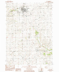
Historical Maps of Polo Through Time
2 maps found
Featured Locations
- Palmyra Township, IL
- Woosung Township, IL
- Grand Detour Township, IL
- Woosung, Woosung Township
- Polo, Buffalo Township
Source Details
SourceU.S. Geological Survey
CopyrightPublic Domain