2024 Map of Polson
USGS Topo · Published 2024About this map
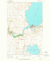
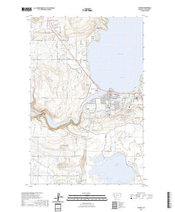
Polson sits prominently on the southern shore of Flathead Lake, where the waters of Polson Bay feed into the Flathead River. This 2024 map documents the sophisticated water management infrastructure essential to the region, including the Polson B Canal, Polson C Canal, and the Pablo 31 A 07 Canal which feeds into the Pablo Reservoir. These engineering works support the agricultural landscape surrounding the town and the Pablo National Wildlife Refuge to the south. Local history is anchored by civic and community sites such as the Lake County Courthouse, Polson Airport, and the Lakeview Cem. Along the west, the terrain rises toward Rocky Butte and Vista Point, overlooking the nearby settlement of Kerr and the winding course of the river. The map provides a detailed view of the growing residential footprints in Jette and the numerous points extending into the lake, such as Kings Point and Rocky Point.
Find a feature on this map
58 named features on this map. Tap any name to fly to it.
Don’t see what you’re looking for? This feature index may not catch every label — zoom into the map to look around manually.
Map Details
Editions of this 2024 Polson Map
This is the sole edition of this map. No revisions or reprints were ever made.