
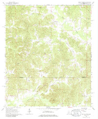
1966 Map of Poplar Creek
USGS Topo · Published 1967About this map
Poplar Creek serves as the central hub of this mid-1960s landscape, located where the Montgomery County and Attala County line divides the region. The map reveals a dispersed rural community defined by its proximity to numerous small waterways like Zilpha Creek, Horse Creek, and Little Poplar Creek. Family and community history are deeply etched into the land, evidenced by a high density of country churches and burial grounds. Notable sites include Poplar Springs Union Ch, Bethesda Ch, and Old Pine Bluff Cem. The topography is shaped by modest elevations such as Arnold Mountain and the presence of a Sandpit, indicating localized industrial activity. The road network and drainage patterns around Bogasha Creek and Armstrong Branch reflect the traditional agricultural and timber-oriented layout of central Mississippi during this era.
Find a feature on this map
28 named features on this map. Tap any name to fly to it.
Don’t see what you’re looking for? This feature index may not catch every label — zoom into the map to look around manually.
Map Details
Editions of this 1966 Poplar Creek Map
2 editions found
Other maps of this area

1953 · West Point
USGS Topo · 1:250,000

1958 · West Point
USGS Topo · 1:250,000

1963 · West Point
USGS Topo · 1:250,000

1964 · Kosciusko NE
USGS Topo · 1:24,000

1964 · Hesterville
USGS Topo · 1:24,000

1966 · Kilmichael
USGS Topo · 1:24,000

1966 · Winona
USGS Topo · 1:24,000

1966 · Kosciusko
USGS Topo · 1:62,500

1966 · Stewart
USGS Topo · 1:24,000

1966 · French Camp
USGS Topo · 1:24,000