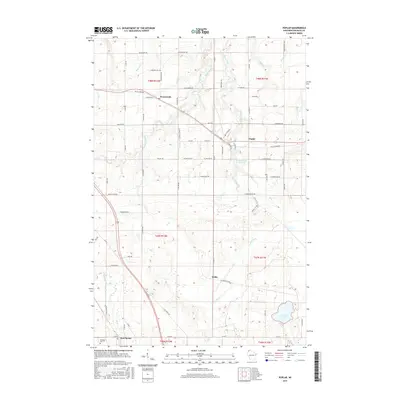
2015 Map of Poplar
USGS Topo · Published 2015About this map
Poplar and Hawthorne anchor this Douglas County landscape, where the drainage systems of the Middle River and Poplar River shape the local topography. This 2015 survey documents the modern layout of rural settlements like Wentworth and the crossroads at Dobie, connected by a network of local roads such as Moonshine Rd and Bayfield Rd. A significant feature of the northern sections is the Tri Co Corridor, which traverses the terrain alongside established railroad paths, reflecting the region's long-standing transportation infrastructure. The map detail is particularly useful for identifying the proximity of small water bodies like Steele Lake and Twin Lakes to the neighboring townships. The presence of numerous family-named routes, including Barsness Rd and S Wiehe Rd, provides valuable data for those researching local land use and residency patterns in northern Wisconsin.
Find a feature on this map
66 named features on this map. Tap any name to fly to it.
Don’t see what you’re looking for? This feature index may not catch every label — zoom into the map to look around manually.
Map Details
Editions of this 2015 Poplar Map
This is the sole edition of this map. No revisions or reprints were ever made.
Other maps of this area

1945 · Highland
USGS Topo · 1:48,000

1945 · Solon Springs
USGS Topo · 1:48,000

1947 · Brule
USGS Topo · 1:48,000

1949 · Solon Springs
USGS Topo · 1:48,000

1949 · Poplar
USGS Topo · 1:48,000

1949 · Highland
USGS Topo · 1:48,000

1953 · Ashland
USGS Topo · 1:250,000

1954 · Lake Nebagamon
USGS Topo · 1:24,000

1954 · Poplar NE
USGS Topo · 1:24,000
1954 · South Range
USGS Topo · 1:24,000