
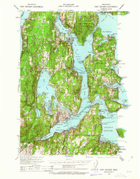
1937 Map of Port Orchard
USGS Topo · Published 1960About this map
Bremerton and the central Kitsap Peninsula thrive as a vital maritime and military hub in this late 1930s survey. The landscape is defined by the massive industrial footprint of the Puget Sound Navy Yard and the Naval Ammunition Depot along Sinclair Inlet, while the Port Madison Indian Reservation occupies the northern reaches near Suquamish. Maritime connectivity is pervasive, illustrated by essential transit routes like the Bremerton-Seattle Ferry and the Brownsville-Fletcher Bay Ferry, which linked these coastal communities before the expansion of modern highway bridges.
Find a feature on this map
101 named features on this map. Tap any name to fly to it.
Don’t see what you’re looking for? This feature index may not catch every label — zoom into the map to look around manually.
Map Details
Editions of this 1937 Port Orchard Map
2 editions found
Other maps of this area

1894 · Seattle
USGS Topo · 1:62,500

1895 · Snohomish
USGS Topo · 1:125,000

1897 · Tacoma
USGS Topo · 1:125,000

1897 · Seattle
USGS Topo · 1:125,000

1900 · Tacoma
USGS Topo · 1:125,000

1908 · Seattle
USGS Topo · 1:62,500

1909 · Seattle Special
USGS Topo · 1:62,500

1936 · Point Misery
USGS Topo · 1:62,500

1937 · Port Gamble
USGS Topo · 1:62,500

1938 · Allyn
USGS Topo · 1:62,500