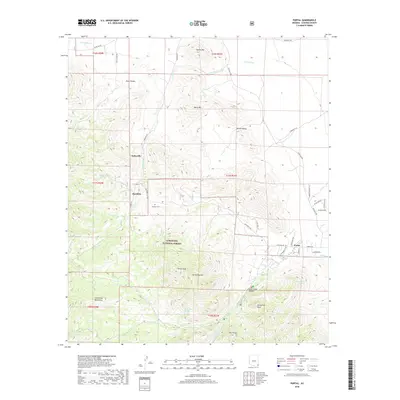
2018 Map of Portal
USGS Topo · Published 2018About this map
Paradise and Portal anchor this part of Cochise County, where the high slopes of the Chiricahua Mountains meet the desert floor. The landscape is defined by dramatic geological features within the Coronado National Forest, including the steep walls of Cave Creek Canyon and the prominent spire of Cathedral Rock. Local history is visible through settlements like Galeyville and the Paradise Cem, which serve as markers of the area's mining and ranching legacy. Water sources are critical in this arid environment, represented by drainage systems like Silver Cr and Cave Cr, along with numerous springs such as Cienega Spring and Hummingbird Spring. The mapping of small mountain roads like Jhus Canyon Rd and Paradise Rd illustrates how human activity has navigated the complex terrain of Silver Peak and Davis Mtn.
Find a feature on this map
51 named features on this map. Tap any name to fly to it.
Don’t see what you’re looking for? This feature index may not catch every label — zoom into the map to look around manually.
Map Details
Editions of this 2018 Portal Map
This is the sole edition of this map. No revisions or reprints were ever made.
Other maps of this area

1917 · San Simon
USGS Topo · 1:125,000

1917 · Chiricahua
USGS Topo · 1:125,000

1919 · Chiricahua
USGS Topo · 1:125,000

1926 · Cochise Head
USGS Topo · 1:62,500

1926 · Rodeo
USGS Topo · 1:62,500

1926 · Rucker
USGS Topo · 1:62,500

1928 · Chenoweth
USGS Topo · 1:62,500

1950 · Cochise Head
USGS Topo · 1:62,500

1950 · Vanar
USGS Topo · 1:62,500

1951 · Vanar
USGS Topo · 1:62,500