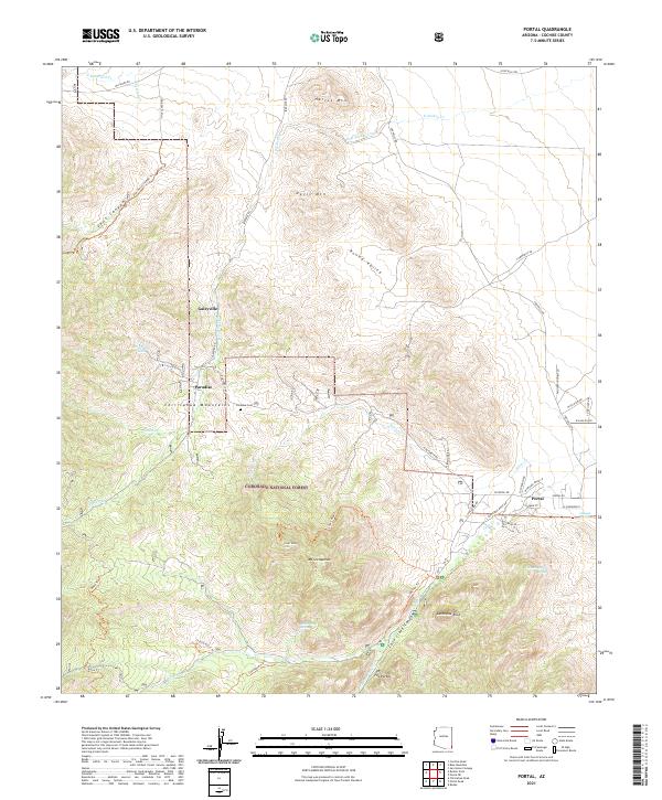
2021 Map of Portal
USGS Topo · Published 2021About this map
The eastern slopes of the Chiricahua Mountains dominate this landscape, where high-elevation springs and rugged canyons meet the high desert. The small community of Portal serves as a gateway to the deep drainage of Cave Creek Canyon, a region defined by its dramatic geology including Cathedral Rock and the prominent limestone cliffs of The Portal. Further north, the map documents the historical footprints of Paradise and Galeyville, settlements that grew from early mining and ranching interests within what is now the Coronado National Forest. This 2021 record preserves the location of the Paradise Cem and numerous family-named landmarks like Harris Mtn and Davis Mtn. The intricate network of trails, such as the Silver Peak Trl and Sunny Flat Trl, illustrates the modern focus on recreation and conservation in this biologically diverse corner of Arizona.
Find a feature on this map
59 named features on this map. Tap any name to fly to it.
Don’t see what you’re looking for? This feature index may not catch every label — zoom into the map to look around manually.
Map Details
Editions of this 2021 Portal Map
This is the sole edition of this map. No revisions or reprints were ever made.
Other maps of this area

1917 · San Simon
USGS Topo · 1:125,000

1917 · Chiricahua
USGS Topo · 1:125,000

1919 · Chiricahua
USGS Topo · 1:125,000

1926 · Cochise Head
USGS Topo · 1:62,500

1926 · Rodeo
USGS Topo · 1:62,500

1926 · Rucker
USGS Topo · 1:62,500

1928 · Chenoweth
USGS Topo · 1:62,500

1950 · Cochise Head
USGS Topo · 1:62,500

1950 · Vanar
USGS Topo · 1:62,500

1951 · Vanar
USGS Topo · 1:62,500