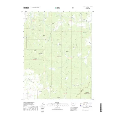
2019 Map of Porter Mountain
USGS Topo · Published 2019About this map
Grand Mesa National Forest and Gunnison National Forest meet in this high-altitude landscape defined by timbered plateaus and secluded mountain meadows. The terrain is characterized by a series of distinct natural parks and flats, including Dead Mare Park, Stillwater Park, and Porter Flat, which have long served as landmarks for high-country navigation and grazing. This 2019 survey documents the complex water management system required for this environment, featuring a network of ditches such as Elizabeth Ditch, Bear Den Ditch, and Castle Ditch that redirect flows across the divide.
Find a feature on this map
64 named features on this map. Tap any name to fly to it.
Don’t see what you’re looking for? This feature index may not catch every label — zoom into the map to look around manually.
Map Details
Editions of this 2019 Porter Mountain Map
This is the sole edition of this map. No revisions or reprints were ever made.
Other maps of this area

1955 · The Meadows
USGS Topo · 1:24,000

1957 · Leadville
USGS Topo · 1:250,000

1959 · Leadville
USGS Topo · 1:250,000

1960 · Leadville
USGS Topo · 1:250,000

1960 · Leon Peak
USGS Topo · 1:24,000

1960 · South Mamm Peak
USGS Topo · 1:24,000

1961 · Electric Mountain
USGS Topo · 1:24,000

1961 · Porter Mountain
USGS Topo · 1:24,000

1961 · Chalk Mountain
USGS Topo · 1:24,000

1961 · Spruce Mountain
USGS Topo · 1:24,000