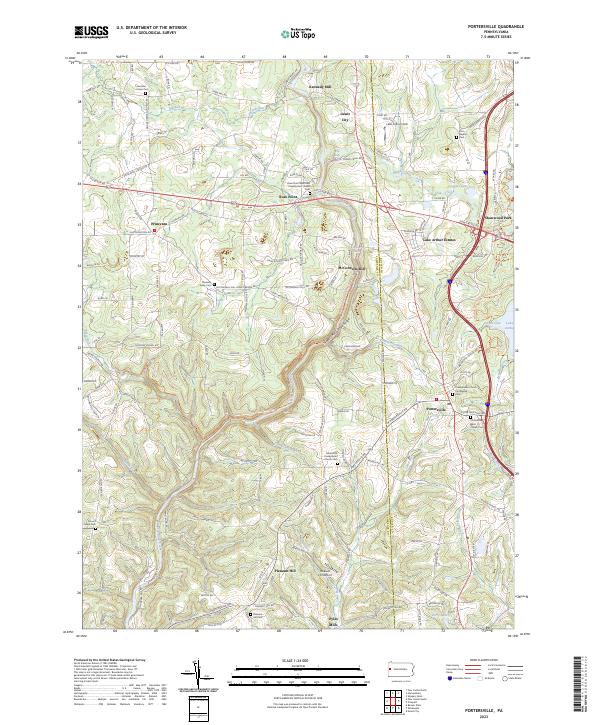
2023 Map of Portersville
USGS Topo · Published 2023About this map
Slippery Rock Creek carves a significant path through this landscape, creating the Slippery Rock Creek Gorge and supporting several historical milling sites. The rural character of both Butler Co and Lawrence Co is evident in the dense network of small communities and family-named landmarks. Settlements like Princeton, Rose Point, and Portersville serve as local anchors, while the presence of Kennedy Mill, McConnells Mill, and Pyles Mills points to a legacy of water-powered industry along the regional runs.
Find a feature on this map
145 named features on this map. Tap any name to fly to it.
Don’t see what you’re looking for? This feature index may not catch every label — zoom into the map to look around manually.
Map Details
Editions of this 2023 Portersville Map
This is the sole edition of this map. No revisions or reprints were ever made.
Historical Maps of Princeton Through Time
Featured Locations
- Lancaster Township, PA
- Portersville, PA
- Slippery Rock Township, PA
- Wayne Township, PA
- Perry Township, PA