2022 Map of Portis
USGS Topo · Published 2022About this map
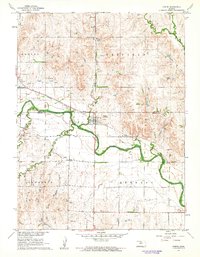
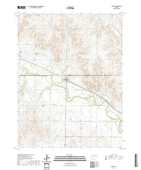
Portis serves as the central hub of this North Central Kansas landscape, situated where Lindley Cr meets the North Fork Solomon River. The terrain is defined by the sharp transition between the fertile river valley and the dissecting drainages of Joy Cr and Laurence Cr. The map reveals a deeply rooted rural community, where the sectional grid of roads like 310 RD and Co RD 362 provides access to several family-named burial grounds including Fairview Cem and Hammond Cem. These small cemeteries and the established town site reflect a long-standing agricultural settlement pattern along the river. In the northeast, the intricate branching of Twelvemile Cr into its eastern and western forks illustrates the complex erosional geography that characterizes the upland prairie surrounding the river bottomlands.
Find a feature on this map
26 named features on this map. Tap any name to fly to it.
Don’t see what you’re looking for? This feature index may not catch every label — zoom into the map to look around manually.
Map Details
Editions of this 2022 Portis Map
This is the sole edition of this map. No revisions or reprints were ever made.