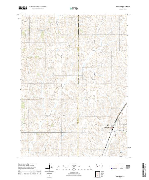
2022 Map of Portsmouth
USGS Topo · Published 2022About this map
Portsmouth serves as the central hub of this agricultural landscape along the border of Harrison and Shelby Counties. The town's grid is anchored by essential community landmarks, including the Post Office and Saint Mary's Cemetery located just to the north. This western Iowa terrain is defined by a dense network of drainage, where Pigeon Creek and its tributary Little Pigeon Creek meander through the northern and central sections, while Mosquito Creek cuts across the southeast corner. The land is strictly organized by the Public Land Survey System, with an extensive grid of rural roads like Cedar Road, Apple Road, and Toledo Avenue providing access to farmsteads across Townships 79 and 80 North. The intersection of these county lines and watercourses illustrates the long-standing relationship between the region's topography and its systematic settlement patterns.
Find a feature on this map
55 named features on this map. Tap any name to fly to it.
Don’t see what you’re looking for? This feature index may not catch every label — zoom into the map to look around manually.
Map Details
Editions of this 2022 Portsmouth Map
This is the sole edition of this map. No revisions or reprints were ever made.
Other maps of this area

1954 · Omaha
USGS Topo · 1:250,000

1957 · Omaha
USGS Topo · 1:250,000

1958 · Omaha
USGS Topo · 1:250,000

1971 · Earling
USGS Topo · 1:24,000

1971 · Dunlap SW
USGS Topo · 1:24,000

1971 · Dunlap
USGS Topo · 1:24,000
1978 · Hard Scratch
USGS Topo · 1:24,000

1978 · Panama
USGS Topo · 1:24,000

1978 · Persia
USGS Topo · 1:24,000
1978 · Woodbine
USGS Topo · 1:24,000