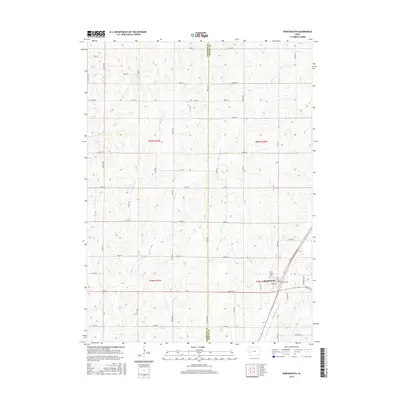
2015 Map of Portsmouth
USGS Topo · Published 2015About this map
Portsmouth serves as the primary hub of this Iowa landscape, situated along the Ia 44 corridor. The town's local history is anchored by Saint Marys Cem, which overlooks the surrounding agricultural grid. The terrain is defined by a dense network of drainage, where Pigeon Cr and Little Pigeon Cr carve through the rolling sections of the county line between Harrison and Shelby Counties.
Find a feature on this map
40 named features on this map. Tap any name to fly to it.
Don’t see what you’re looking for? This feature index may not catch every label — zoom into the map to look around manually.
Map Details
Editions of this 2015 Portsmouth Map
This is the sole edition of this map. No revisions or reprints were ever made.
Other maps of this area

1954 · Omaha
USGS Topo · 1:250,000

1957 · Omaha
USGS Topo · 1:250,000

1958 · Omaha
USGS Topo · 1:250,000

1971 · Earling
USGS Topo · 1:24,000

1971 · Dunlap SW
USGS Topo · 1:24,000

1971 · Dunlap
USGS Topo · 1:24,000
1978 · Hard Scratch
USGS Topo · 1:24,000

1978 · Panama
USGS Topo · 1:24,000

1978 · Persia
USGS Topo · 1:24,000
1978 · Woodbine
USGS Topo · 1:24,000