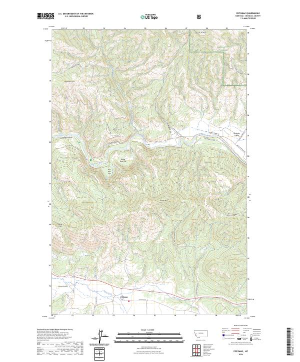
2024 Map of Potomac
USGS Topo · Published 2024About this map
Potomac sits within a landscape defined by the winding course of the Blackfoot River and the high ridges of the Lolo National Forest. This 2024 survey captures the rural character of Missoula County, where the settlement of Camas Prairie and the flatter reaches of Goose Rock Flat and Red Rock Flat contrast with the surrounding mountain peaks. The drainage patterns of Belmont Creek, Little Belmont Creek, and Union Creek illustrate the watershed that feeds the main river valley, a region long defined by timber and ranching.
Find a feature on this map
32 named features on this map. Tap any name to fly to it.
Don’t see what you’re looking for? This feature index may not catch every label — zoom into the map to look around manually.
Map Details
Editions of this 2024 Potomac Map
This is the sole edition of this map. No revisions or reprints were ever made.
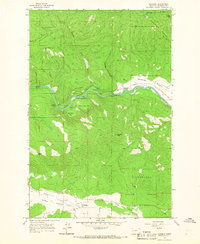
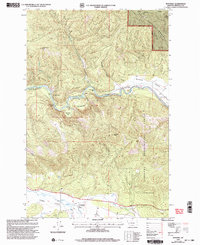
Historical Maps of Potomac Through Time
3 maps found