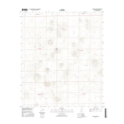
2017 Map of Potrillo Peak
USGS Topo · Published 2017About this map
The West Potrillo Mountains dominate this high-desert landscape in Doña Ana County, defined by a series of volcanic peaks and ridges. The prominent Potrillo Peak rises as a central landmark within this arid terrain. Water management in this dry environment is evidenced by several named stock tanks or catchments, including Jays Tank, Bills Tank, Hagens Tank, and Barbaras Tank, which are critical for supporting life and ranching in the Chihuahuan Desert. This survey provides a precise view of the topography and land divisions within several townships and ranges, including t27s r4w and t27s r3w, showcasing the sparse human footprint and the reliance on scattered water sources across the mountain range.
Find a feature on this map
12 named features on this map. Tap any name to fly to it.
Don’t see what you’re looking for? This feature index may not catch every label — zoom into the map to look around manually.
Map Details
Editions of this 2017 Potrillo Peak Map
This is the sole edition of this map. No revisions or reprints were ever made.
Other maps of this area

1917 · Camel Mountain
USGS Topo · 1:62,500

1917 · Mt. Riley
USGS Topo · 1:62,500

1918 · Mt. Riley
USGS Topo · 1:62,500

1929 · Mt. Riley
USGS Topo · 1:62,500

1941 · Aden
USGS Topo · 1:62,500

1943 · Aden
USGS Topo · 1:62,500

1951 · Mt. Riley
USGS Topo · 1:62,500

1953 · El Paso
USGS Topo · 1:250,000

1955 · Las Cruces
USGS Topo · 1:250,000

1958 · Las Cruces
USGS Topo · 1:250,000