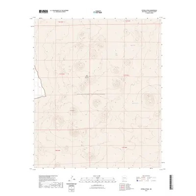
2023 Map of Potrillo Peak
USGS Topo · Published 2023About this map
Potrillo Peak rises as a prominent landmark within the high desert landscape of West Potrillo Mountains, a region defined by its volcanic geology and arid basin drainage. Much of this terrain is preserved within the Organ Mountains-Desert Peaks National Monument, where the lack of perennial streams has led to the development of numerous earthen tanks for water storage. These isolated water sources, including Bills Tank, Hagens Tank, Jays Tank, and Barbaras Tank, are critical focal points in an otherwise dry expanse. The map details the complex topographic contours of the volcanic field, showing the various cinder cones and lava flows that characterize this part of the Chihuahuan Desert. This survey provides a precise look at the land's relief and the sparse infrastructure used to manage water in this remote corner of New Mexico.
Find a feature on this map
13 named features on this map. Tap any name to fly to it.
Don’t see what you’re looking for? This feature index may not catch every label — zoom into the map to look around manually.
Map Details
Editions of this 2023 Potrillo Peak Map
This is the sole edition of this map. No revisions or reprints were ever made.
Other maps of this area

1917 · Camel Mountain
USGS Topo · 1:62,500

1917 · Mt. Riley
USGS Topo · 1:62,500

1918 · Mt. Riley
USGS Topo · 1:62,500

1929 · Mt. Riley
USGS Topo · 1:62,500

1941 · Aden
USGS Topo · 1:62,500

1943 · Aden
USGS Topo · 1:62,500

1951 · Mt. Riley
USGS Topo · 1:62,500

1953 · El Paso
USGS Topo · 1:250,000

1955 · Las Cruces
USGS Topo · 1:250,000

1958 · Las Cruces
USGS Topo · 1:250,000