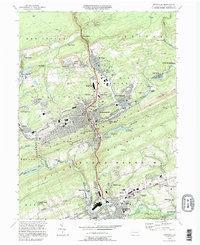
1994 Map of Pottsville
USGS Topo · Published 1995About this map
The Schuylkill River carves a path through this coal-region landscape, where the anthracite legacy is visible in the Strip Mines surrounding St Clair and New Philadelphia. The urban density of Pottsville and Minersville contrasts with the steep, wooded ridges of Sharp Mountain and Second Mountain, showing a corridor of industrial and residential growth concentrated in the valleys. Notable for its many religious and community landmarks, the area contains numerous burial grounds like German Cem and Odd Fellows Cem, alongside the Penn State University Schuylkill Campus near Schuylkill Haven. The hydrology of the region is highly managed, featuring the Tumbling Run Reservoir No 1 and Indian Run Reservoir, which supported the municipal needs of these historic boroughs during the late twentieth century.
Find a feature on this map
83 named features on this map. Tap any name to fly to it.
Don’t see what you’re looking for? This feature index may not catch every label — zoom into the map to look around manually.
Map Details
Editions of this 1994 Pottsville Map
This is the sole edition of this map. No revisions or reprints were ever made.
Other maps of this area

1889 · Catawissa
USGS Topo · 1:62,500

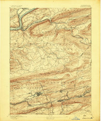
1889 · Pottsville
USGS Topo · 1:62,500

1891 · Pottsville
USGS Topo · 1:62,500

1892 · Catawissa
USGS Topo · 1:62,500

1892 · Mahanoy
USGS Topo · 1:62,500

1892 · Pine Grove
USGS Topo · 1:62,500

1893 · Mahanoy
USGS Topo · 1:62,500
1894 · Catawissa
USGS Topo · 1:62,500
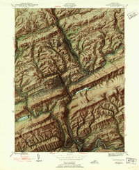
1944 · Pottsville
USGS Topo · 1:24,000
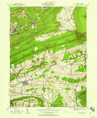
1944 · Orwigsburg
USGS Topo · 1:24,000