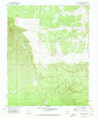
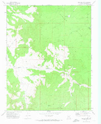
1971 Map of Poverty Spring
USGS Topo · Published 1973About this map
Poverty Spring and Dewdrop Spring provide the eponymous water sources for this high-elevation corner of Mohave County during the early 1970s. The landscape is defined by the massive rise of Poverty Mountain and the deep incisions of Hidden Canyon, which cuts through the Hidden Hills in the western half of the quadrangle.
Find a feature on this map
26 named features on this map. Tap any name to fly to it.
Don’t see what you’re looking for? This feature index may not catch every label — zoom into the map to look around manually.
Map Details
Editions of this 1971 Poverty Spring Map
This is the sole edition of this map. No revisions or reprints were ever made.
Other maps of this area

1886 · Mt. Trumbull
USGS Topo · 1:250,000

1892 · Mt. Trumbull
USGS Topo · 1:250,000

1953 · Grand Canyon
USGS Topo · 1:250,000

1957 · Grand Canyon
USGS Topo · 1:250,000

1958 · Grand Canyon
USGS Topo · 1:250,000

1960 · Grand Canyon
USGS Topo · 1:250,000
1971 · Wildcat Ranch
USGS Topo · 1:24,000
1971 · Poverty Knoll
USGS Topo · 1:24,000
1971 · Grassy Mountain
USGS Topo · 1:24,000
1971 · Mustang Point
USGS Topo · 1:24,000