2021 Map of Powder River
USGS Topo · Published 2021About this map
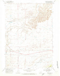
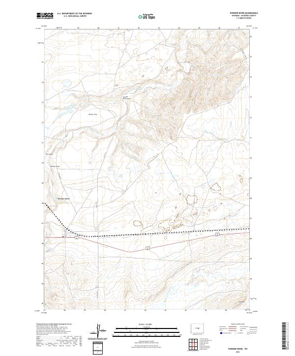
The S Fork Powder River winds through this high plains landscape of Natrona County, where the topography is defined by complex drainage systems and livestock heritage. In the northern reaches, Brewer Flat and the Brewer Reservoir provide a focus for water management in an otherwise arid environment. The map details a network of canyons and depressions, including Powder River Draw, Ohio Draw, and Hohnen Draw, which channel seasonal runoff toward the river. Transportation and commerce are represented by a mix of infrastructure, from the industrial-inflected Oil Camp Rd in the south to the Cottonwood Stock Trl in the northeast. To the southeast, the terrain rises toward the slopes of Pine Mtn, while the southern drainage of Middle Fork Casper Cr marks the divide between major watersheds. Local access is maintained through established routes like Notches Rd and various county roads that serve the ranching and resource extraction interests of the region.
Find a feature on this map
19 named features on this map. Tap any name to fly to it.
Don’t see what you’re looking for? This feature index may not catch every label — zoom into the map to look around manually.
Map Details
Editions of this 2021 Powder River Map
This is the sole edition of this map. No revisions or reprints were ever made.