2023 Map of Powhatan Point
USGS Topo · Published 2023About this map
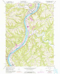
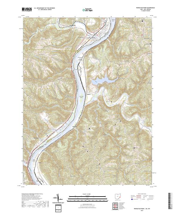
The Ohio River corridor defines the landscape of this 2023 survey, serving as the border between Belmont and Monroe counties in Ohio and Marshall County in West Virginia. Major riverfront settlements like Powhatan Point and Clarington anchor the western shore, while the eastern bank features industrial sites at Cresap and Natrium. The terrain is characterized by a series of prominent ridges such as Arman Ridge, German Ridge, and Taylors Ridge, intersected by deep hollows and runs. Industrial land use is evident at the Quarto Mine Number Four Dam Number Five near Franklin. Genealogists will find numerous family and community burial sites, including the Saint Johns Cem, Graysville Cem, and Rine Yoho Cem, which are scattered throughout the winding road network of the uplands.
Find a feature on this map
125 named features on this map. Tap any name to fly to it.
Don’t see what you’re looking for? This feature index may not catch every label — zoom into the map to look around manually.
Map Details
Editions of this 2023 Powhatan Point Map
This is the sole edition of this map. No revisions or reprints were ever made.