Loading...
Loading map...1967 Map of Prescott
USGS Topo · Published 1971About this map
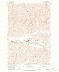
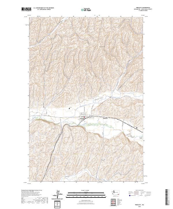
Prescott serves as the focal point of this 1967 survey, situated where the Union Pacific railroad and Lyons Road converge in the Touchet Valley. The town's economic reliance on agriculture is clearly marked by prominent Grain Elevators along the tracks and the nearby McCall loading point. High on the valley's northern rim, the Skyrocket Hills rise above the river, cut by deep drainages like Winnett Canyon and Piper Canyon.
Find a feature on this map
23 named features on this map. Tap any name to fly to it.
Don’t see what you’re looking for? This feature index may not catch every label — zoom into the map to look around manually.
Map Details
Date Portrayed1967
Date Published1971
PublisherU.S. Geological Survey
Map TypeTopographic
Scale1:24,000
Physical Dimensions22 x 26.8 inches
Editions of this 1967 Prescott Map
This is the sole edition of this map. No revisions or reprints were ever made.
Historical Maps of Prescott Through Time
6 maps found
Featured Locations
Source Details
SourceU.S. Geological Survey
CopyrightPublic Domain