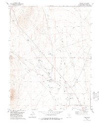
1979 Map of Preston
USGS Topo · Published 1988About this map
Preston serves as the focal point of this Nevada landscape, where the importance of water management in a high-desert environment is evidenced by a dense network of springs and reservoirs. The community is situated near several significant water sources, including Preston Big Spring, Cold Spring, and named seeps like Nicholas Spr and Arnoldson Spr. These features, alongside Blackjack Res and Lower Preston Res, suggest a settlement pattern deeply tied to local hydrology and livestock ranching.
Find a feature on this map
20 named features on this map. Tap any name to fly to it.
Don’t see what you’re looking for? This feature index may not catch every label — zoom into the map to look around manually.
Map Details
Editions of this 1979 Preston Map
2 editions found
Other maps of this area

1952 · Ely
USGS Topo · 1:125,000

1956 · Lund
USGS Topo · 1:250,000

1956 · Ely
USGS Topo · 1:250,000

1958 · Ely
USGS Topo · 1:62,500

1959 · Ely
USGS Topo · 1:250,000

1959 · Preston Reservoir
USGS Topo · 1:62,500

1960 · Lund
USGS Topo · 1:250,000

1963 · Ely
USGS Topo · 1:250,000
1977 · Brown Knoll
USGS Topo · 1:24,000
1977 · Sawmill Canyon
USGS Topo · 1:24,000