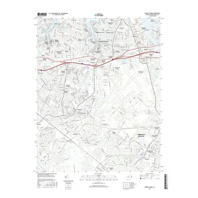
2016 Map of Princess Anne
USGS Topo · Published 2016About this map
Princess Anne and the surrounding neighborhoods of Virginia Beach are defined by an intricate network of tidal inlets and suburban expansion in this mid-2010s survey. The landscape is dominated by the sprawling Oceana Naval Air Station/Apollo Soucek Field, which occupies a significant portion of the eastern quadrant. Residential developments like Kings Grant, Wolfsnare Plantation, and Chesopeian Colony are woven between the fingers of the Western Branch Lynnhaven River and the Eastern Branch Lynnhaven River.
Find a feature on this map
92 named features on this map. Tap any name to fly to it.
Don’t see what you’re looking for? This feature index may not catch every label — zoom into the map to look around manually.
Map Details
Editions of this 2016 Princess Anne Map
This is the sole edition of this map. No revisions or reprints were ever made.
Other maps of this area

1893 · Virginia Beach
USGS Topo · 1:125,000

1907 · Norfolk
USGS Topo · 1:125,000

1916 · Back Bay
USGS Topo · 1:62,500

1918 · Cape Henry
USGS Topo · 1:62,500

1919 · Cape Henry
USGS Topo · 1:62,500

1939 · Moyock
USGS Topo · 1:62,500

1943 · Back Bay
USGS Topo · 1:62,500

1946 · Moyock
USGS Topo · 1:62,500

1946 · Eastville
USGS Topo · 1:250,000

1946 · Currituck Sound
USGS Topo · 1:250,000