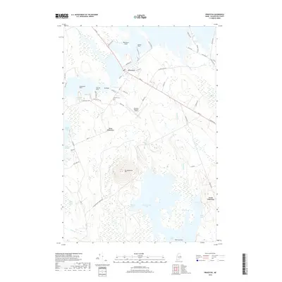
2018 Map of Princeton
USGS Topo · Published 2018About this map
Pocomoonshine Lake and the surrounding Washington County marshlands dominate this landscape, where complex water systems connect through The Narrows and The Basin. The town of Princeton serves as the central hub, situated along Us Rte 1 and organized around a grid of local thoroughfares including Main St and Mill St. To the south, the terrain rises significantly at Pocomoonshine Mtn, overlooking expansive wetlands such as Elijah Brown Heath and Sawtelle Heath. This 2018 survey captures the rural character of the region, documenting small settlements like West Princeton and South Princeton alongside essential infrastructure like the Princeton Municipal Airport. Genealogists will find the exact locations of the Princeton Cem and Lakeview Cem particularly useful for tracing local family history in this forested lake district.
Find a feature on this map
69 named features on this map. Tap any name to fly to it.
Don’t see what you’re looking for? This feature index may not catch every label — zoom into the map to look around manually.
Map Details
Editions of this 2018 Princeton Map
This is the sole edition of this map. No revisions or reprints were ever made.
Other maps of this area

1929 · Calais
USGS Topo · 1:48,000

1932 · Calais
USGS Topo · 1:62,500

1940 · Waite
USGS Topo · 1:62,500

1940 · Kellyland
USGS Topo · 1:62,500

1941 · Big Lake
USGS Topo · 1:62,500

1942 · Kellyland
USGS Topo · 1:62,500

1942 · Waite
USGS Topo · 1:62,500

1943 · Big Lake
USGS Topo · 1:62,500

1952 · Big Lake
USGS Topo · 1:50,000

1957 · Fredericton
USGS Topo · 1:250,000