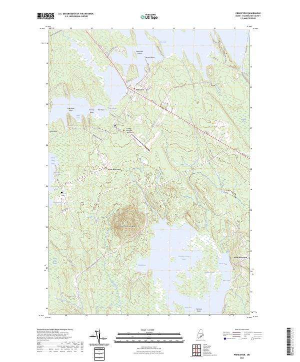
2024 Map of Princeton
USGS Topo · Published 2024About this map
Princeton serves as the focal point for this survey of Washington County, Maine, positioned where US Rte 1 and Main St intersect near The Narrows. The landscape is defined by the complex aquatic network of Big Lake and Pocomoonshine Lake, featuring distinctive landforms such as Black Bird Island and Pocomoonshine Mtn. For local historians and genealogists, the map identifies residential and community markers including West Princeton, South Princeton, and burials at Princeton Cem and Lakeview Cem.
Find a feature on this map
70 named features on this map. Tap any name to fly to it.
Don’t see what you’re looking for? This feature index may not catch every label — zoom into the map to look around manually.
Map Details
Editions of this 2024 Princeton Map
This is the sole edition of this map. No revisions or reprints were ever made.
Other maps of this area

1929 · Calais
USGS Topo · 1:48,000

1932 · Calais
USGS Topo · 1:62,500

1940 · Waite
USGS Topo · 1:62,500

1940 · Kellyland
USGS Topo · 1:62,500

1941 · Big Lake
USGS Topo · 1:62,500

1942 · Kellyland
USGS Topo · 1:62,500

1942 · Waite
USGS Topo · 1:62,500

1943 · Big Lake
USGS Topo · 1:62,500

1952 · Big Lake
USGS Topo · 1:50,000

1957 · Fredericton
USGS Topo · 1:250,000