2022 Map of Pulaski
USGS Topo · Published 2022About this map
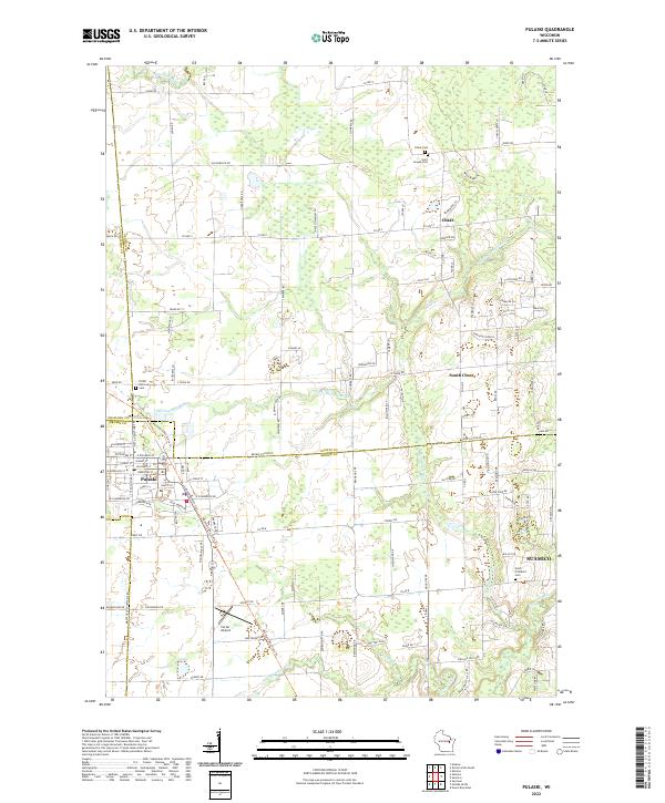
Pulaski serves as a primary hub where the borders of Shawano and Oconto counties meet the northern edge of Brown County. The landscape is defined by the drainage systems of the Pensaukee River, Little Suamico River, and the Suamico River, which wind through a mosaic of agricultural plots and wetlands. Local heritage is preserved in several community landmarks, including the Polish National Cem near the town center and the Saint Joseph Cem located further north in the settlement of Chase. This modern survey illustrates the persistent rural character of the region, anchored by established hamlets like South Chase and technical infrastructure such as Carter Airport. The transition from the more developed street grid of Pulaski into the surrounding townships reflects the long-standing agricultural and residential patterns of this multi-county junction.
Find a feature on this map
57 named features on this map. Tap any name to fly to it.
Don’t see what you’re looking for? This feature index may not catch every label — zoom into the map to look around manually.
Map Details
Editions of this 2022 Pulaski Map
This is the sole edition of this map. No revisions or reprints were ever made.