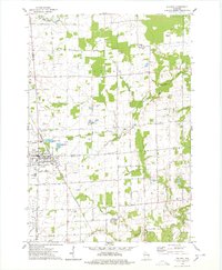
1974 Map of Pulaski
USGS Topo · Published 1978About this map
The village of Pulaski serves as the focal point of this mid-1970s landscape, sitting at the junction of Brown, Oconto, and Shawano counties. The community is anchored by the prominent Franciscan Monastery and the Chicago and Northwestern railroad line, which cuts diagonally across the township. Further north, the settlement of Chase and the rural area of South Chase characterize a terrain defined by the winding Little Suamico River and its branches. This survey highlights a rural infrastructure of small-town institutions, from the Glenbrook Sch to the multiple burial grounds including Polish National Cem and Township Cem. The landscape reveals a transition toward modern land use with the presence of Carter Airport and various industrial operations, including several Gravel Pits and Sandpits scattered throughout the glacial topography near Potter Creek.
Find a feature on this map
47 named features on this map. Tap any name to fly to it.
Don’t see what you’re looking for? This feature index may not catch every label — zoom into the map to look around manually.
Map Details
Editions of this 1974 Pulaski Map
This is the sole edition of this map. No revisions or reprints were ever made.
Other maps of this area

1954 · Green Bay West
USGS Topo · 1:24,000

1954 · Green Bay
USGS Topo · 1:62,500

1955 · Seymour
USGS Topo · 1:62,500

1955 · Green Bay
USGS Topo · 1:250,000

1956 · Gillett
USGS Topo · 1:62,500

1956 · Oconto Falls
USGS Topo · 1:62,500

1974 · Seymour
USGS Topo · 1:24,000

1974 · Abrams
USGS Topo · 1:24,000

1974 · Zachow
USGS Topo · 1:24,000
1974 · Oconto Falls South
USGS Topo · 1:24,000