2024 Map of Pulaski
USGS Topo · Published 2024About this map
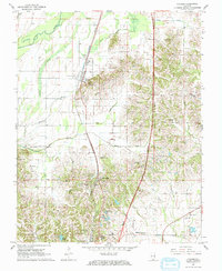
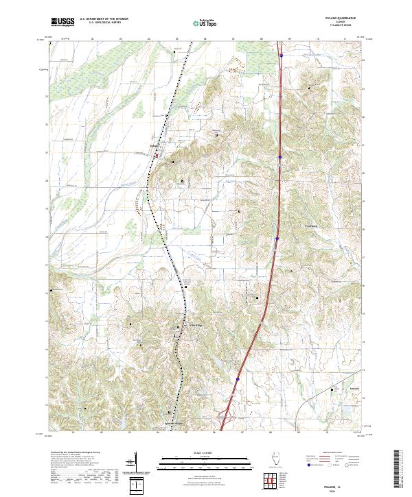
Cypress Creek National Wildlife Refuge dominates the western landscape of this southern Illinois region, where the Cache River and its associated wetlands like Cypress Slough and Pulaski Slough create a complex hydrographic network. The settlement pattern follows the higher ground along the railroad and highway corridors, connecting Pulaski and Villa Ridge to the south. The map is a significant resource for genealogical research, documenting an exceptional density of burial sites including Rose Hill Cem, Cairo City Cem, and both the Old Shiloh Cem and New Shiloh Cem. These markers, along with family-named landmarks and smaller communities like Pryortown and America, provide a clear picture of the longstanding rural communities and church-centered settlements that have shaped the county's social geography.
Find a feature on this map
95 named features on this map. Tap any name to fly to it.
Don’t see what you’re looking for? This feature index may not catch every label — zoom into the map to look around manually.
Map Details
Editions of this 2024 Pulaski Map
This is the sole edition of this map. No revisions or reprints were ever made.