Loading...
Loading map...2023 Map of Pullman
USGS Topo · Published 2023About this map
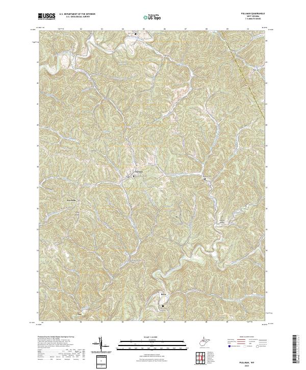
The North Fork Hughes River and South Fork Hughes River carve distinct drainage patterns through this portion of the West Virginia highlands, defining the landscape around the community of Pullman. This area, characterized by a complex network of runs and creeks, supports several established settlements and rural outposts. The map reveals a high density of small cemeteries, including the Pullman Church Cem near the town center and the Pine Grove Cem further south near Berea.
Find a feature on this map
83 named features on this map. Tap any name to fly to it.
Don’t see what you’re looking for? This feature index may not catch every label — zoom into the map to look around manually.
Map Details
Date Portrayed2023
Date Published2023
PublisherU.S. Geological Survey
Map TypeTopographic
Scale1:24000
Physical Dimensions24 x 29 inches
Editions of this 2023 Pullman Map
This is the sole edition of this map. No revisions or reprints were ever made.
Historical Maps of Five Forks Through Time
Featured Locations
Source Details
SourceU.S. Geological Survey
CopyrightPublic Domain