2024 Map of Pyatt
USGS Topo · Published 2024About this map
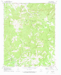
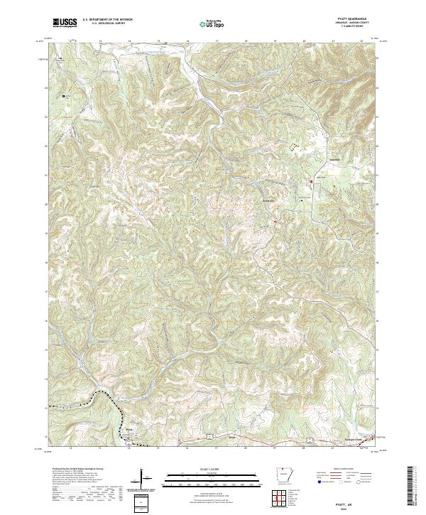
Dodd City and the surrounding Marion County uplands are defined by a complex network of hollows and ridges that descend toward the winding paths of Crooked Creek and Sugar Orchard Creek. This modern survey reveals a landscape where historical burial grounds like Derryberry Cem and Keesee Cem remain as markers of early settlement, even as newer infrastructure such as Marion Co 3001 and Tranquil Ridge DR navigates the difficult terrain. The map's detail provides a window into the hydrology of the Ozarks, tracing dozens of seasonal branches and permanent springs, including Marble Falls Spring and Sailor Spring. Significant topographical features like Mining House Hollow suggest a history of local resource extraction, while named ridges like Linton Ridge and high points like Clark Hill dictate the layout of small communities from Pyatt in the southwest to the rural crossroads of Lakeway and Snow.
Find a feature on this map
123 named features on this map. Tap any name to fly to it.
Don’t see what you’re looking for? This feature index may not catch every label — zoom into the map to look around manually.
Map Details
Editions of this 2024 Pyatt Map
This is the sole edition of this map. No revisions or reprints were ever made.