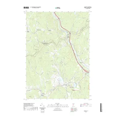
2021 Map of Quechee
USGS Topo · Published 2021About this map
White River and the Ottauquechee River carve through this Windsor County landscape, framing a series of early settlements and upland farms. The terrain is defined by prominent heights like Howe Hill, Thistle Hill, and Seaver Hill, with the Appalachian National Scenic Trail winding across the ridges. Small villages and crossroads like Quechee, West Hartford, and Taftsville serve as historic focal points, while many family-named roads such as Sue Spaulding Rd and Howe Hill Rd suggest deep-rooted local history.
Find a feature on this map
115 named features on this map. Tap any name to fly to it.
Don’t see what you’re looking for? This feature index may not catch every label — zoom into the map to look around manually.
Map Details
Editions of this 2021 Quechee Map
This is the sole edition of this map. No revisions or reprints were ever made.
Other maps of this area

1896 · Strafford
USGS Topo · 1:62,500

1906 · Hanover
USGS Topo · 1:62,500

1908 · Hanover
USGS Topo · 1:62,500

1911 · Woodstock
USGS Topo · 1:62,500

1913 · Woodstock
USGS Topo · 1:62,500

1919 · Royalton
USGS Topo · 1:62,500

1924 · Randolph
USGS Topo · 1:48,000

1926 · Randolph
USGS Topo · 1:62,500

1943 · Woodstock
USGS Topo · 1:62,500

1944 · Strafford
USGS Topo · 1:62,500