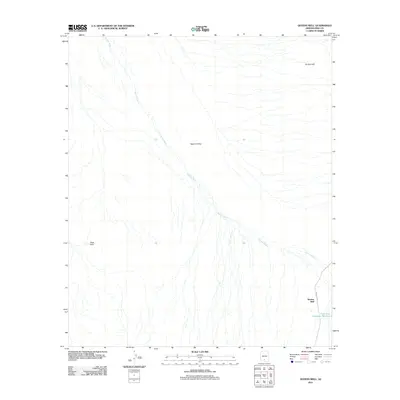
2011 Map of Queens Well
USGS Topo · Published 2011About this map
Aguirre Valley dominates this desert landscape in Pima County, defined by the extensive drainage network of Aguirre Wash as it flows southeast. This 2011 survey captures the area within the Schuk Toak District, where water management is central to the few named landmarks. The namesake settlement of Queens Well sits near the eastern edge, supported by infrastructure like Tank One Hundred Thirteen. The terrain is framed by the Vaca Hills to the southwest and Ka Kohl Hill in the northeast, providing clear topographical markers in an otherwise broad alluvial plain. Modern access is primarily facilitated by Indian Rte 35, which cuts through the southeastern corner of the quadrangle, linking this remote desert region to the broader road network of southern Arizona.
Find a feature on this map
7 named features on this map. Tap any name to fly to it.
Don’t see what you’re looking for? This feature index may not catch every label — zoom into the map to look around manually.
Map Details
Editions of this 2011 Queens Well Map
This is the sole edition of this map. No revisions or reprints were ever made.
Other maps of this area

1934 · Silver Bell
USGS Topo · 1:125,000

1937 · Comobabi
USGS Topo · 1:48,000

1938 · San Vicente
USGS Topo · 1:62,500

1941 · San Vicente
USGS Topo · 1:62,500

1942 · San Vicente
USGS Topo · 1:62,500

1942 · Comobabi
USGS Topo · 1:62,500

1948 · San Vicente
USGS Topo · 1:62,500

1956 · Tucson
USGS Topo · 1:250,000

1958 · Tucson
USGS Topo · 1:250,000

1959 · Tucson
USGS Topo · 1:250,000