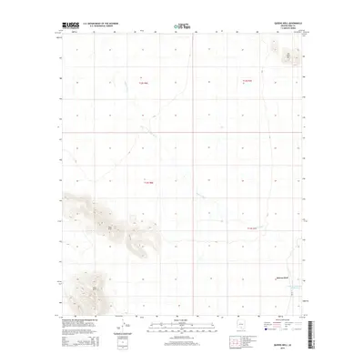
2014 Map of Queens Well
USGS Topo · Published 2014About this map
The desert landscape of the Schuk Toak District is defined by the extensive Aguirre Wash, which drains the arid basins between prominent uplifted formations. The Vaca Hills and Ko Kohl Hill provide significant topographic relief, rising sharply above the surrounding desert floor. Human presence is concentrated near Queens Well, a small settlement positioned at the intersection of local routes in the southeastern corner of the quadrangle. The infrastructure here is heavily tied to water management in a dry environment, evidenced by the Tank One Hundred Thirteen and the primary roadway Bia-35. This survey captures the sparse but critical network of landmarks necessary for navigation and survival in this portion of Pima County.
Find a feature on this map
10 named features on this map. Tap any name to fly to it.
Don’t see what you’re looking for? This feature index may not catch every label — zoom into the map to look around manually.
Map Details
Editions of this 2014 Queens Well Map
This is the sole edition of this map. No revisions or reprints were ever made.
Other maps of this area

1934 · Silver Bell
USGS Topo · 1:125,000

1937 · Comobabi
USGS Topo · 1:48,000

1938 · San Vicente
USGS Topo · 1:62,500

1941 · San Vicente
USGS Topo · 1:62,500

1942 · San Vicente
USGS Topo · 1:62,500

1942 · Comobabi
USGS Topo · 1:62,500

1948 · San Vicente
USGS Topo · 1:62,500

1956 · Tucson
USGS Topo · 1:250,000

1958 · Tucson
USGS Topo · 1:250,000

1959 · Tucson
USGS Topo · 1:250,000