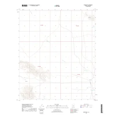
2018 Map of Queens Well
USGS Topo · Published 2018About this map
Aguirre Wash carves a dominant path through this Sonoran desert landscape within the Schuk Toak District, Pima County. The terrain is defined by the prominent Vaca Hills in the southwest and the isolated height of Ka Kohl Hill to the northeast, illustrating the basin-and-range topography characteristic of the region. Human presence in this arid environment is concentrated at Queens Well, a vital water point located along Indian Rte 35. The map also documents the drainage systems of House Wash and specialized water infrastructure such as Tank One Hundred Thirteen, highlighting the critical importance of water management in this part of southern Arizona.
Find a feature on this map
11 named features on this map. Tap any name to fly to it.
Don’t see what you’re looking for? This feature index may not catch every label — zoom into the map to look around manually.
Map Details
Editions of this 2018 Queens Well Map
This is the sole edition of this map. No revisions or reprints were ever made.
Other maps of this area

1934 · Silver Bell
USGS Topo · 1:125,000

1937 · Comobabi
USGS Topo · 1:48,000

1938 · San Vicente
USGS Topo · 1:62,500

1941 · San Vicente
USGS Topo · 1:62,500

1942 · San Vicente
USGS Topo · 1:62,500

1942 · Comobabi
USGS Topo · 1:62,500

1948 · San Vicente
USGS Topo · 1:62,500

1956 · Tucson
USGS Topo · 1:250,000

1958 · Tucson
USGS Topo · 1:250,000

1959 · Tucson
USGS Topo · 1:250,000