
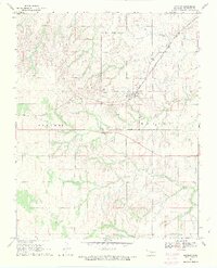
1969 Map of Quinlan
USGS Topo · Published 1971About this map
Quinlan serves as the central hub of this Woodward County landscape, situated along the steel corridor of the Atchison Topeka and Santa Fe railroad. The region is defined by a series of north-south drainage networks including Cuddy Creek, West Creek, and Ewers Creek, which cut through the terrain of the Liberty and Garvey districts. This late-1960s survey documents a rural economy transitioning toward energy extraction, evidenced by numerous Gas Wells and a Drill Hole scattered across the township lines of T. 23 N. and T. 22 N.
Find a feature on this map
19 named features on this map. Tap any name to fly to it.
Don’t see what you’re looking for? This feature index may not catch every label — zoom into the map to look around manually.
Map Details
Editions of this 1969 Quinlan Map
2 editions found
Other maps of this area

1955 · Woodward
USGS Topo · 1:250,000

1958 · Woodward
USGS Topo · 1:250,000

1969 · Mooreland SE
USGS Topo · 1:24,000

1969 · Belva
USGS Topo · 1:24,000

1969 · Mooreland
USGS Topo · 1:24,000

1969 · Cedardale
USGS Topo · 1:24,000

1969 · Waynoka West
USGS Topo · 1:24,000

1969 · Mooreland SW
USGS Topo · 1:24,000

1970 · Fairvalley SW
USGS Topo · 1:24,000

1970 · Fairvalley SE
USGS Topo · 1:24,000