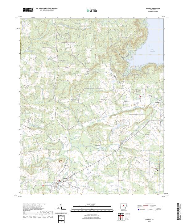
2024 Map of Quitman
USGS Topo · Published 2024About this map
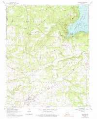
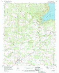
Quitman sits at a crossroads of early transit and natural barriers in Cleburne County, where the southern foothills of the Ozarks meet the drainage of Cadron Creek. The landscape is defined by its dramatic relief, featuring prominent heights like Pryor Mountain and White Oak Mtn that overlook a complex network of hollows such as Sweet Suck Hollow and Sulphur Springs Hollow. In the northeast, the waters of Greers Ferry Lake reach into the terrain at Goff Cove, illustrating how modern water management has reshaped the local geography. Small settlements like Crossroads and Pearson are connected by a web of local roads including Edgemont Rd and Quitman Rd, which trace the high ridges and creek valleys. For those researching local family history, the Aldridge Cem remains a quiet landmark on the eastern edge of the quadrangle.
Find a feature on this map
110 named features on this map. Tap any name to fly to it.
Don’t see what you’re looking for? This feature index may not catch every label — zoom into the map to look around manually.
Map Details
Editions of this 2024 Quitman Map
This is the sole edition of this map. No revisions or reprints were ever made.
Historical Maps of Quitman Through Time
3 maps found