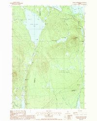
1988 Map of Ragged Mountain
USGS Topo · Published 1988About this map
Upper Jo-Mary Lake and South Twin Lake dominate this northern Maine wilderness during the late 1980s, revealing a landscape defined by complex water systems and township divisions. The map captures the meeting point of several administrative tracts, including T 4 Indian Purchase, Veazie Gore, and Long A.
Find a feature on this map
34 named features on this map. Tap any name to fly to it.
Don’t see what you’re looking for? This feature index may not catch every label — zoom into the map to look around manually.
Map Details
Editions of this 1988 Ragged Mountain Map
This is the sole edition of this map. No revisions or reprints were ever made.
Other maps of this area

1940 · Sebec
USGS Topo · 1:48,000

1943 · Sebec
USGS Topo · 1:62,500

1947 · Schoodic
USGS Topo · 1:62,500

1949 · Schoodic
USGS Topo · 1:62,500

1951 · Norcross
USGS Topo · 1:62,500

1952 · Jo-Mary Mountain
USGS Topo · 1:62,500

1954 · Millinocket
USGS Topo · 1:250,000

1958 · Millinocket
USGS Topo · 1:250,000

1960 · Millinocket
USGS Topo · 1:250,000
1978 · Norcross
USGS Topo · 1:24,000