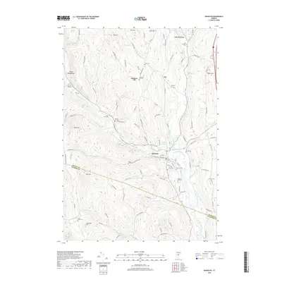
2018 Map of Randolph
USGS Topo · Published 2018About this map
Randolph and its surrounding hill settlements define this central Vermont landscape as documented in 2018. The village center is established at the confluence of the Third Branch White River and Ayers Brook, serving as a hub for the many winding roads that climb the neighboring ridges. The map highlights a strong ancestral footprint through its numerous burial sites, including the Braintree Hill Cem and the Roswell Ford Cem near Lower Branch Cem. To the north, the terrain rises toward Ferry Hill and Oak Hill, while the valley floors are dominated by the winding course of the Third Branch White River. The transition between Orange Co and Windsor Co is marked across the southern slopes of Deer Mtn, where the landscape remains largely defined by its rural character and proximity to small waterways like Smith Brook and Gilead Brook.
Find a feature on this map
110 named features on this map. Tap any name to fly to it.
Don’t see what you’re looking for? This feature index may not catch every label — zoom into the map to look around manually.
Map Details
Editions of this 2018 Randolph Map
This is the sole edition of this map. No revisions or reprints were ever made.
Other maps of this area

1915 · Rochester
USGS Topo · 1:62,500

1917 · Rochester
USGS Topo · 1:62,500

1919 · Royalton
USGS Topo · 1:62,500

1919 · Lincoln Mountain
USGS Topo · 1:62,500

1920 · Lincoln Mountain
USGS Topo · 1:48,000

1921 · Lincoln Mountain
USGS Topo · 1:62,500

1922 · Barre
USGS Topo · 1:48,000

1924 · Barre
USGS Topo · 1:62,500

1924 · Randolph
USGS Topo · 1:48,000

1926 · Randolph
USGS Topo · 1:62,500