Loading...
Loading map...2024 Map of Raynesford
USGS Topo · Published 2024About this map
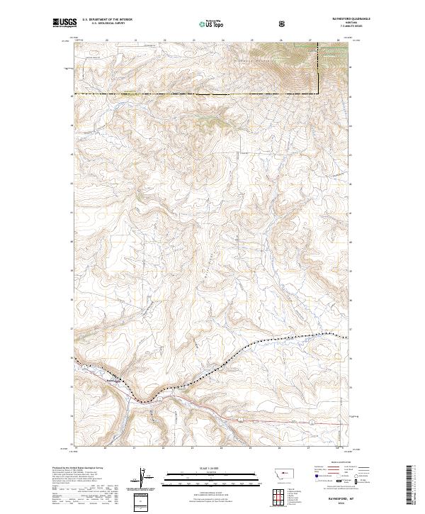
Raynesford serves as the primary settlement on this modern landscape, situated where the central plateau meets the descending drainages of the Big Otter Creek. The map documents the boundary between Cascade and Judith Basin counties, a region defined by high-elevation features like the Highwood Mountains and South Peak to the north. These uplands are protected within the Lewis & Clark National Forest, which covers the northeastern corner of the quadrangle.
Find a feature on this map
39 named features on this map. Tap any name to fly to it.
Don’t see what you’re looking for? This feature index may not catch every label — zoom into the map to look around manually.
Map Details
Date Portrayed2024
Date Published2024
PublisherU.S. Geological Survey
Map TypeTopographic
Scale1:24000
Physical Dimensions24 x 29 inches
Editions of this 2024 Raynesford Map
This is the sole edition of this map. No revisions or reprints were ever made.
Historical Maps of Raynesford Through Time
Featured Locations
Source Details
SourceU.S. Geological Survey
CopyrightPublic Domain