Loading...
Loading map...2022 Map of Red Oak
USGS Topo · Published 2022About this map
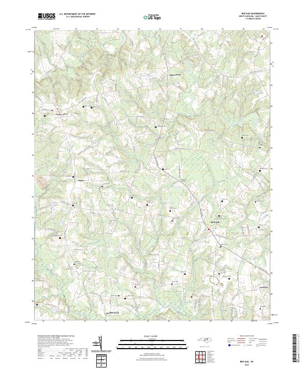
Saint Johns Church and its neighboring Saint Johns Cem serve as a focal point for this rural landscape in north-central Nash County. The terrain is defined by the winding paths of Swift Creek and Sandy Creek, which drain toward the larger Pig Basket Cr to the south. The settlement pattern here is distinctly distributed, with small communities like Hilliardston, Taylors Store, and Dukes situated at key crossroads.
Find a feature on this map
122 named features on this map. Tap any name to fly to it.
Don’t see what you’re looking for? This feature index may not catch every label — zoom into the map to look around manually.
Map Details
Date Portrayed2022
Date Published2022
PublisherU.S. Geological Survey
Map TypeTopographic
Scale1:24000
Physical Dimensions24 x 29 inches
Editions of this 2022 Red Oak Map
This is the sole edition of this map. No revisions or reprints were ever made.
Historical Maps of Dortches Through Time
Featured Locations
Source Details
SourceU.S. Geological Survey
CopyrightPublic Domain