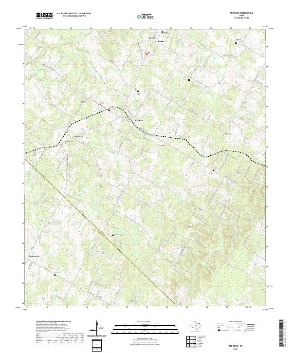
2022 Map of Red Rock
USGS Topo · Published 2022About this map
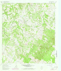
The boundary between Bastrop Co and Caldwell Co cuts diagonally across this Central Texas landscape, anchoring a rural network of small settlements and family-named cemeteries. Red Rock sits at the center, served by Lentz Main St and Sandhills Rd, while Rockne and the Sacred Heart Catholic Cem define the northern reaches. The area is characterized by a dense system of seasonal drainages, including Upper Cedar Hollow and Lower Elm Cr, which flow toward the Sandy Fork of the Colorado River basin.
Find a feature on this map
91 named features on this map. Tap any name to fly to it.
Don’t see what you’re looking for? This feature index may not catch every label — zoom into the map to look around manually.
Map Details
Editions of this 2022 Red Rock Map
This is the sole edition of this map. No revisions or reprints were ever made.