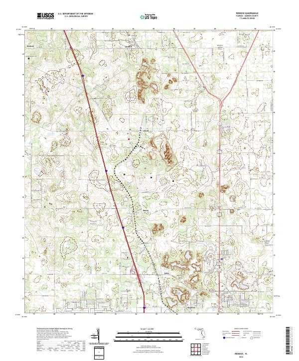
2024 Map of Reddick
USGS Topo · Published 2024About this map
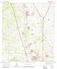
Reddick serves as the central hub in this portion of Marion County, where the landscape is defined by its agricultural character and aviation history. The corridor along NW Gainesville Rd and the parallel interstate connect a series of small, long-standing communities including Lowell, Martin, and Zuber. These settlements reflect the region's rural development patterns, with many properties remaining dedicated to large-scale farming, as evidenced by Lee Farms Airport and other private landing strips like Wings-N-Wheels Airport.
Find a feature on this map
138 named features on this map. Tap any name to fly to it.
Don’t see what you’re looking for? This feature index may not catch every label — zoom into the map to look around manually.
Map Details
Editions of this 2024 Reddick Map
This is the sole edition of this map. No revisions or reprints were ever made.